On the flight to Atlanta the guy next to me was commenting that flying through Salt Lake City would have been much shorter. Well since this was a mileage run the extra long flights were on purpose. Now I'm a proud Delta Silver Medallion member. Was it worth it? Well,yeah! I got to go backpacking in the Rincon Mountains by Tucson, AZ.
I packed light. The only things I didn't take along on the hike where my iPod,sport shorts (for the hotel pool), a nylon laundry bag (in case the backpack needed to be checked) and a "man-purse". I used the extra bag to keep the backpack within the dimensions of the carry on. It worked well. The pack fit into the overhead compartments of the MD88 and the 757 without trouble. TSA didn't made a fuss about the camping gear either.
Driving to Summithut (an outdoor sports store) to get the camping fuel did take some time. There I also filled my water bladders. I decided to take six liters with me. On the way out I stopped at a grocery and got tortillas, two apples, two cucumbers to take along,and water to keep in the car. I also got a foot long sandwich at Subway. Next time I have to remember not just to skip the mayo and similar toppings off but also the wet vegetables (tomatoes, pickles, etc).
The drive out to the Miller Creek trailhead is a long one. Not just the interstate but also the 16 miles of gravel road. On it though you enter a pretty cool landscape. So even the drive was scenic. I finally got to the trailhead at 3pm. The hard part was then to repack everything into the backpack especially since it was late and I wanted to be on my way.
 |
| Drive to the Miller Creek Trail Head |
 |
| Miller Creek Trail Head |
 |
| First part of Miller Creek Trail |
Right at the trailhead you have to go through a gate. It was the first one of many. The ascent along Miller Creek was nice as it took me past many big holders. A dark thunder cloud came which started to worry me a little. As the first few big droplets fell I stopped to put the camera away and put the rain cover on the pack. Surprisingly that was all that came down. Once I got to the Heartbreak Ridge trail my climb was done and the Happy Valley camp came up quite quickly. It was moved closer and I was expecting it to be at the old location.
 |
| At the Saguaro National Park border |
 |
| View from the Miller Creek Trail |
 |
| Heartbreak Ridge Trail to Happy Valley Saddle Camp |
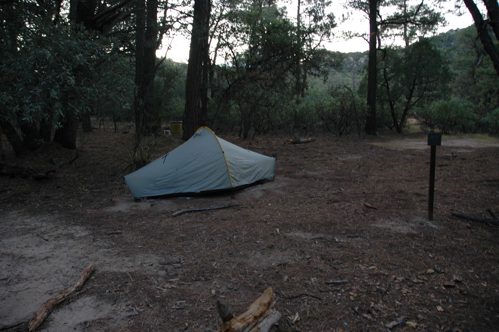
I checked out the campsites, three in total of which only two have bear lockers. The campsite furthest back was already taken. I looked in the other bear locker which looked like a pantry. People left peanut butter, beer, a whole pound of sugar (what's that for?) and other crap. I decided to go to the old camp site to see if there are bear lockers. Nothing besides the old camp sign was left and it had a note "closed" on it. So I went back and cleared out the bear locker and stuffed all the junk into a barrel nearby.
 |
| Happy Valley Camp |
I had just enough time to setup camp before it got dark. I ate my soggy sub and then headed to the camp site with the two backpacks but no owner. I was about to check their backcounty permit since I was a little worried about them since it was totally dark by now. Just then the owners hiked in with flashlights. They were a young teacher couple that just returned from Rincon Peak. I retired at around 7pm. A few big drops awoke me and I was expecting rain but again that was all that came down.
The next morning I broke down camp and stashed most of my belongings in the bear box. I didn't feel like cooking so I just ate pop-tart and some snacks of breakfast. Then I headed off to climb Rincon Peak.
 |
| Rincon calling |
 |
| Rincon Peak Trail |
 |
| Heartbreak Ridge and Happy Valley Saddle |
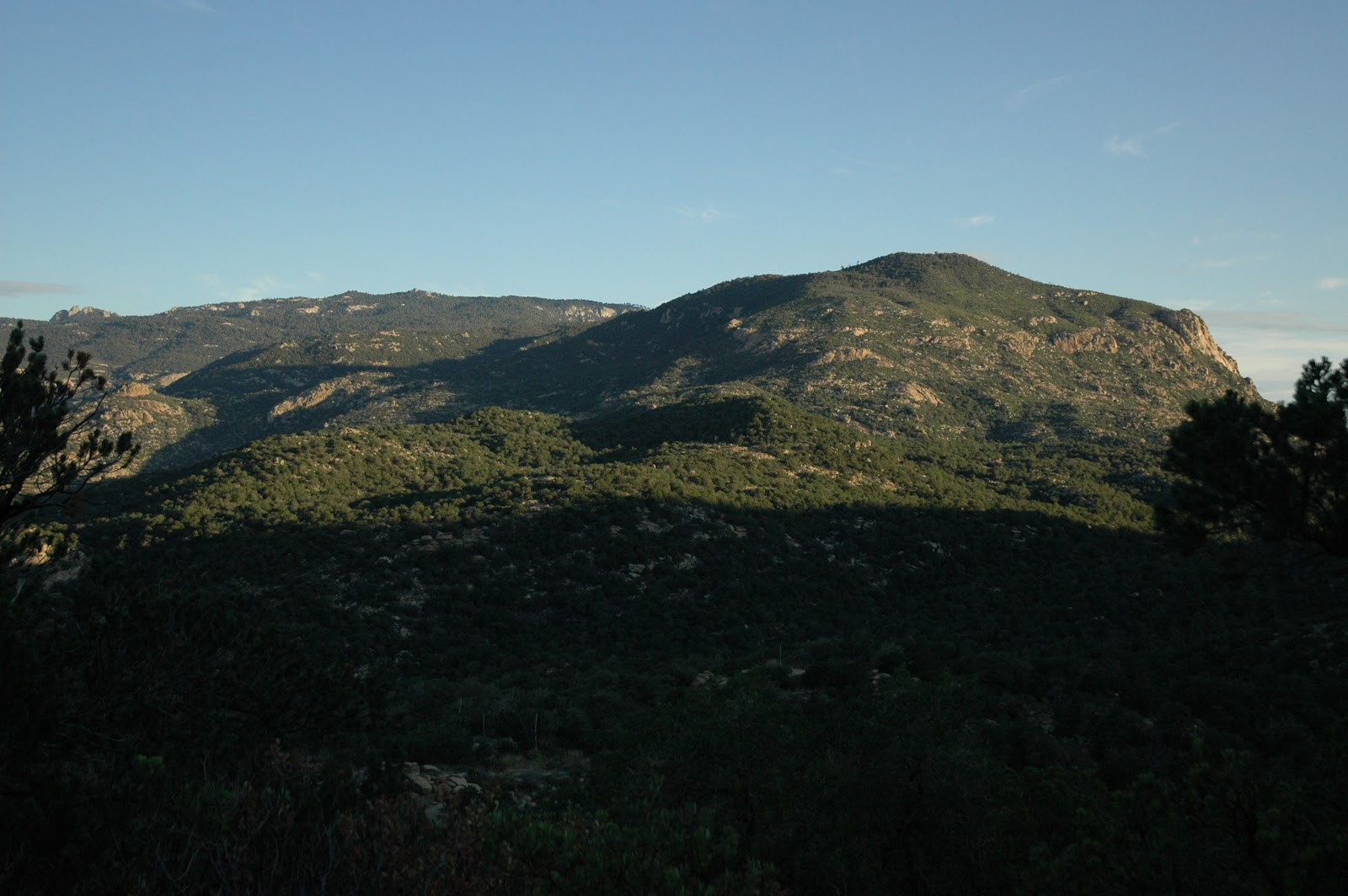
The last 1/2 mile of the ascent is quite steep but the view from the peak is quite worth it. Best view of the whole hike. I ate a pack of tuna with tortillas up there while enjoying the scenery. On my way back to Happy Valley camp I meet two guys that were hiking the Rincon as a dayhike.
 |
| Cactus enjoying the view from Rincon Peak |
 |
| Victory! |
After getting my stuff and feeding the few but always active mosquitoes at Happy Valley camp I found that there was a toilet hidden on the north side of the camp. It turned out that every camp had a toilet.
I was hoping that the Heartbreak Ridge Trail would continue through the nice forest vegetation but it soon started with a long incline that was mode miserable by the midday heat and sun. That section had only low vegetation, probably due to a fire a while ago, and no shade. That's where my misery for the day started. The view of Rincon Mountain, the Happy Valley and what I hiked in the morning was excellent though. The little side excursion to the Happy Valley Lookout wasn't to rewarding as the view from there isn't great. There is however a toilet behind the building.
 |
| Rincon Peak and Happy Valley |
 |
| Heartbreak Ridge Trail |
I continued on the Heartbreak Ridge train and went to Manning via part of the Fire Loop trail. It seemed like I was going horrible slow since I didn't feel well. I couldn't quite figure out why but it seemed to be an abdominal thing. Short rests didn't seem to help much. Because of that I didn't enjoy this stretch of the hike much.
 |
| Heartbreak Ridge Trail |
 |
You might get burned
when reaching for the sky |
 |
| Lizard |
Near the Manning area, while hiking through the highest part of the trail (8200 feet), thunder clouds with cloud-to-cloud lightning was above me and I wondered when it would hit ground being so close to the clouds. Again I was just being scared by thunderstorm but did not get any rain. I meet a group families hiking from Manning to Spud Rock camp, dressed in rain gear. Because I didn't feel well and wanted to get to my camp I kept the encounter short. It turned out that the ranger and her interns that came back from Spud Rock got hit by the rain. I still can't believe that.
 |
| Fire Loop Trail |
Strangely once I arrived at Manning I started to feel better quite quickly. There I was the only camper besides the ranger and the interns. The sign-in box is quite unique with a deer skull complete with antlers and postcards with photos of the Manning family by the cabin. Thanks to the ranger the toilets even had toilet paper and the one closest to the cabin had a bucket sink and soap.
 |
| Registration Book at Manning Camp |
All staff at Manning has their own permanent tent structure to sleep in. The cabin has the kitchen and dining room. They have a big bench press equipment although the intern girls ensured me that they weren't using it. Apparently the interns hike to various springs with the ranger to monitor them.
 |
| Creek at Manning |
 |
| Camp Site |
 |
| Manning Cabin |
I talked to the ranger about my options between taking the Heartbreak Ridge and Miller Creek trails back or the Turkey Creek trail and hike the four wheel drive road between the trailheads to the car. I decided on taking the Turkey Creek trail even though it was a couple miles longer and I'd hike the gravel road between the trail heads in the midday heat. But it featured a steady decent and a new area of the Rincon Mountains.
 |
| Spud Rock |
 |
| At Turkey Creek Trail |
 |
| Neat Plant |
 |
| Lower part of the Turkey Creek Trail |
 |
| Hikers at the Logbook |
On my way to Spud Rock the Ranger and interns caught up while I was taking a break. I followed them to Spud Rock where our ways split. Except for a slip, which planted my rear on some pokey plant, the decent was quite uneventful. I passed the families that camped at Spud Rock on the lower section of the Turkey Creek Trail. They were heading home as well but had their SUV parked at the end of the four wheel drive road.
 |
Turkey Creek Trail at the
Saguaro National Park border |
 |
| Rincon Peak, Happy Valley Saddle and Heartbreak Ridge |
|
 |
| Four-wheel-drive Road |
The trickiest part of the hike was following the gravel road. At one point an unmarked split came up and at first I took to wrong way. So, when in doubt take the road with the gate. Going toward Miller Creek trailhead I encountered three horses that were running up to me and looking at me expectantly. I also noticed some horse slobber on my car once I got there.
 |
| Between the two trailheads |
 |
| Free roaming horses |
This ended my hike. I drove back to the hotel, washed the car (rental companies don't like it when you take their cars on gravel roads) and my cloths, got dinner and retired. The flight back was uneventful and provided me with plenty of time writing this blog entry on paper.