Sunday, August 19, 2012

Oregon Coast Ride: Back to Portland

Finally caught up with the blog posts of the Oregon Coast Ride. The night went OK. I setup the tent at dusk behind some trees out of sight from the street and neighbors. I was a little worried about the neighbors not knowing what was going on but nobody bothered me. I got up and tore down the tent at the crack of dawn and left the area. For the morning wash-up I stopped by the public restrooms at the tourist information again.

At the bus stop and Porter Stage Lines office quite a few people gathered to ride the bus. Quite a bit of the discussion was about the bad economy in this area and that the logging restrictions/environmentalism is the major cause of it. It was surreal riding on the bus and seeing how quickly we rode through most of yesterdays ride. In Eugene I purchased the Amtrak bus ticket to Portland and had a delicious brunch at the Morning Glory Cafe right next to the station.

The next week I spend mostly working with my team at the hotel but I did get some nice rides in. One morning I did a loop along the Willamette River. Another morning I rode up to the Japanese and Rose Garden and looped around Washington Park and Hoyt Arboretum.

Portland Rose Garden

Oh, and for my next adventure I'll probably start writing daily paper blogs and then publishing them after the trip. Writing blogs on an android phone is near to impossible and I can't upload full resolution photos with labels. Also tweeting caused me issues as so many tweets failed to be send. So I ended up writing most of the blog a couple weeks after the ride which is not ideal. I guess low tech is the way to go in the future.

Saturday, August 18, 2012

Oregon Coast Ride: No Room at the Inn

Bennie and Julie invited to ride with them today. Our speeds are fairly similar. The only times I lagged behind was going down hill. At around 16 mph I top out with pedaling and rely purely on coasting. My bike also didn't seem to coast as fast as theirs but with 16 inch wheels I really didn't need to go any faster. From my GPS track it looks like the top speed was about 28 mph on the monster hill of Thursday.

Julie and Benny.

Quite a bit of today's ride was away from the ocean. Either through the forest or behind the large sand dunes.

Sand dune.

Ben and Julie on highway 101.

At the end of the day we had to cross the Coos Bay bridge. We pushed the bikes along the narrow sidewalk of this huge bridge. At the middle of the bridge I dropped a flower and watched it's way to the water. It was amazing to see how long it took because the bridge was so tall. After the bridge I bid farewell to Benny and Julie as they continued on to the next state park. I kind of envied them for being able to continue on, especially since the next section would be away from highway 101. But I needed to head back to Portland tomorrow and attend to the real business of my trip to Oregon. Yes, I'll have to do some real work.

Obligatory bike route sign photo.

Julie and Benny checking out the monster bridge we need to cross.

Getting a bus ride is apparently quite simple.  You just pay the Porter Stage Line driver and then get the Amtrak ticket in Eugene to continue to Portland.

The tricky part is that the bus leaves at 7:15am and all state parks and campsites are pretty far away.  The RV park right next to the Casino in Coos Bay doesn't allow any tents.  Neither does the city in any of their parks.  Hotels are all full with the exception for some suites that have prices that should pay a taxi to Portland.

Arrived at Coos Bay

Tugboats in Coos Bay

When asking the pastor at the local Catholic church if he knew a place to pitch a tent, the church had a pretty nice grassy courtyard, he suggested the local shelter.

After having been turned down by hotels and the RV park I was going toward the shelter.  On the way I rode through a residential area and saw Tim working on an inflatable boat in his yard.  I tried my luck and asked him if he'd knew anywhere or anybody that would let me pitch a tent for the night.  I told him my story about having ridden down the coast and catching a bus at 7 in the morning.  He offered the open lot across the street.  I asked if it's really OK with the owner and he assured that it is.

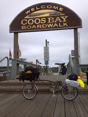
I went back to downtown and the boardwalk where I could use the public restroom and cooked my last freeze dried meal for dinner before heading back to the open lot at sunset.

Day 4: 75 miles
Carl Washburne State Park to Coos Bay
http://www.bikemap.net/route/1807258

Friday, August 17, 2012

Oregon Coast Ride: Surfing USA

Today I rode by myself again.  In the morning I passed a surf shop that wasn't open but had a photo-op place outside by the road. Today's ride was pretty nice as the road goes close to the ocean.  I set a pleasurable pace and stopped here and there.  I once went out on a sandy beach, wanting to push the bike along the beach for a while but I just got the bike sandy.  The tide was coming in and the beach wouldn't have been great to go a distance along it.  So it was back to the road again.

Brompton out on the surf.

Siletz Bay.

The Pacific coast.

Self portrait.

I'm not sure if Depoe Bay does really have the smallest harbor, it still looked kind of big to me, but it has an impressive narrow entrance through rock walls over which the 101 bridge spans.

If the sign says so it must be true.
The Otter Crest Loop south of Depoe Bay was the best stretch to ride.  It runs parallel to 101 and due to it's narrowness is primarily a one-way street.  Barely any traffic was on that road and no trucks or RVs.  The scenery and view were gorgeous there as well.  I wish the whole Pacific route could be like that.

One way street parallel to 101 and the best
section I rode.

More Pacific coast.

Look at that, the laundry got dry.

Cycling along highway 101.

Not only did I meet up again with Bennie and Julie at the Carl Washburne state park but I also met Christopher (http://reaveschrisjr.blogspot.com/) who is hiking the Pacific Crest Trail. The ride along the Pacific is quite humbling. No matter how huge of an adventure you think you're undertaking it's puny compared to other people's.  This is especially so on the well traveled Pacific coast route.  But it's also quite exciting to meet with these people and exchange stories after a day of traveling.

Hiker/Biker Camp at Carl Washburne State Park.

Day 3: 63 miles
Devil's Lake State Park to Carl Washburne State Park
http://www.bikemap.net/route/1807254

Thursday, August 16, 2012

Oregon Coast Ride: Jungle Trees

With the fog over night nothing dries. Even my helmet pads that were dry in the evening are soaked in the morning thanks to the salt deposits from sweat. Not much one can do about the helmet but to dry clothing you'd just have to hang them out on your bike and become a moving clothing line.

Daily clothes drying ritual.

Views along the road while crossing a monster hill.

Devil's Lake state park is quite neat as it's nestled in the middle of Lincoln City by a lake.  Right across the street (Hwy 101) is the ocean.  So after setting the tent up I headed over there to stroll a little along the beach.

Lincoln City beach.

Message to home.

Proof that I was really there.

At the campsite I meet several other cyclist.  A guy with a trailer did down and up loop along the coast and was on his way back home.  He considered this a training ride for a bigger and more remote ride to come.  That at least was his excuse for hauling way more than needed.  Surprisingly he slept in quite late the next morning.

Two college guys from Eugene, OR were on their first little tour.  Hey went ultra light, as they didn't bring a sleeping mat or tent.  They just rolled their sleeping bags out and slept in the open.

Also at the camp site were Bennie and Julie which I meet earlier in the day. They are riding from Portland to San Fransisco. We rode together up and down the monster hill of about 750 vertical feet. Surprisingly it wasn't as bad as I'd expected and we did the up and down in about 35 minutes. All of that on US Highway 101 since the Slab Creek Road route is closed.

Hiker-biker campsite at Devil's Lake

Day 2: 58 miles
Barview County Park to Devil's Lake State Park
http://www.bikemap.net/route/1807253

Wednesday, August 15, 2012

Oregon Coast Ride: What a Wreck

Frank cooked me oatmeal and tea before we headed for the Peter Iredale shipwreck right at the Fort Stevens state park.  A nice asphalt trail leads to it as well as the rest of the park.  Its a really nice park and wouldn't mind to spend there a long weekend with the family.  The kids would really like it.

Video of the shipwreck in eerie fog.

Onboard the Iredale.

The remnants show the size of the ship.

I rode with Frank a portion of the day. We stopped together for lunch in Cannon Beach and went through the Arch Cape tunnel.  Frank decided it was better to push the bike through the tunnel.  I looked for a large gap in the traffic and rode quickly through the tunnel.  Only a couple cars passed me at the end.

Haystack Rock in Cannon Beach.

Frank emerging from the Arch Cape tunnel.

Apropos traffic, it's horrible on highway 101.  There was lots of traffic especially midday when the weather was nice.  Nobody is giving any room to bicyclist or slowing down.  Drivers ignore you totally and would run you over if you're in their way.  Trucks and especially RVs are the worst because of their size.  Sometimes they themselves barely fit on the road.  Certainly not a bicycle friendly route even though it's marked as such and a major Adventure Cycling Association route.  The road itself varies from smooth wide shoulder to no shoulder and ruff and patched road.  It's certainly not as nice and relaxing as riding Iowa rural highways.  In the morning and evening the fog reduced visibility but traffic was lighter so I actually felt safer during those times.  I could bitch quite a bit about the traffic but I won't just as I had to focus myself on the other things during the ride as not to get into a crappy mood throughout the ride.

The loaded Brompton taking a rest.

View of Nehalem Bay

Highway 101

Due to a bad knee Frank took it slow up hills, often pushing his bicycle.  The reduced gearing on the Brompton did exceptionally well on the hills and I lost Frank soon after the tunnel.  I stopped at the top of the second, the highest hill of the day, to wait for him.  But after writing a postcard and enjoying the view I decided to continue on.

I stayed overnight at Barview Jetty county campground and I didn't like it as much as any of the state parks that I stayed during the trip.  The hiker/bikers campsites weren't together so it's not easy to socialize with each other.  The campsites themselves were sandy which is quite messy.  Also you have the extra cost of the showers, which are coin operated like a car wash.

Sand sledding hill at Barview county park

Sandy camping site.

Day 1: 55 miles
Fort Stevens State Park to Barview County Park
http://www.bikemap.net/route/1807251

Tuesday, August 14, 2012

Oregon Coast Ride: Reached the Coast

Portland, Oregon is where I will spend a week for work.  To spice the trip up a little I added some personal days up front to ride my Brompton folding bike down the coast.  This is the first of several blog entries about the bike tour.

Flying always seem to cause a long day. Got up at 4 am to catch my flight out to Portland and after a long layover there I made camp at Fort Stephens State Park at about 10pm.

Bike in hard shell, T-bag packed and ready to go along with
tent and sleeping mat in other suitcase. Oh, yeah some stuff
for the work part of the trip as well.

At a park in Portland where I killed some time.

On the bus to Warrenton I meet Frank with whom I rode in the dark to the hikers/bikers campsite.  He's from California riding the coast for nine days south to California.  There I also met Anders (http://bicycle.plato.se) from Sweden who rode his bike across the US and will finish soon in Seattle.

High tech schedule board at the Amtrak station in Portland.

Wednesday, July 25, 2012

Half Day on RAGBRAI

Since RAGBRAI was passing near our home town my eight year old son and I went to ride part of it with the trail-a-bike.  We started in Story City and went the 44 miles to Marshalltown in about 6 1/2 hours.  9 am was certainly not to early to start as the crowds are already passing through Story City.  People must have gotten an early start with the high temperatures today (100 degrees Fahrenheit or a bit more).

My son did great and had lots of fun.  Of course his highlight was in Marshalltown when we rode side by side with another kid on a trail-a-bike and he could talk with him.  I wish though he would let me rest a little longer at some of the breaks but he wanted to keep pushing forward. Especially at the beginning when the saw all the people passing by us.  Later he must have figured out that there are always more people coming, an never ending flow of them, and even requested some short rests.

Riding with the Adams trail-a-bike was though due to the hitch slop.  Whenever he shifted weight, be it from pedaling or something else, my bike gets suddenly pushed to one side or another.  So I had to make sure to keep the bike under control and be ready to act on it.  This meant that I had to keep both hands constantly on the handle bar.  People passing closely and cutting in front of me didn't help either.  A tandem for such rides would be extremely nice.

Special thanks goes out to all the people and organizations that provided free water, bananas and other treats on the way. My son was saying that we couldn't do the ride other times since there wouldn't be places to fill up our water bottles.  I disagree, we would just have used the two liters of water that we hauled the whole way.

What a great father-son day!

In McCallsburg for a shaved ice break

Enjoying a turkey leg

Resting on top of a hill

Celebratory jump at the end

Oh, ... and me

The route

Friday, June 1, 2012

SON Hub Dynamo lighting on Brompton

During the Oxford to Atlanta ride I ended up riding in the dark on the bike trail. I had a very bright spot right in front of my front light which wasn't great when going fast.

So tonight I was adjusting the light and went out for a four mile test ride.  It was a beautiful night and the bike rode so nicely again that I didn't want to turn around.  Adjusting the light so that the glass goes strait up and down (i.e 90 degree to the ground) is about correct.  You get a well lit cone and it makes a world of difference compared with how it was before.

I compared the head light with my Planet Bike 2 Watt Blazer and found it outperformed it slightly.  The cool part is that it keeps the beam low where you need the light and doesn't blind oncoming traffic.  The Blazer has a round beam that shines quite high.  You can tell the difference when both lights are pointed at a wall.  All that light that's high up blinding oncoming traffic didn't help any on the dark and wooden bike trail.

The tail light is quite bright as well.  I compared it to the Planet Bike Superflash (on steady light) and the Superflash is just barely brighter.  When I looked the bike was standing and I'm not sure if the rear light is dimming any when the hub doesn't generate electricity. I'm impressed with the light output as well as the angle that the light can be seen.  I certainly wouldn't be hesitant to ride with the SON Hub Dynamo lighting on my Brompton at night.

It's probably needless to say that with the dynamo hub one doesn't need to worry about batteries and that the lights have a stand light feature so you won't stand in the dark when you stop.  It would be interesting to compare the lights with the much cheaper Shimano Hub Dynamo lighting options.

Monday, May 21, 2012

GAC: An out of the ordinary adventure

I try plan my hikes and rides so that they are somewhat efficient and gentle to the equipment and me. This means that I hike along hiking trails and ride asphalt roads with little traffic. I put some thoughts into it to make it enjoyable. But this weekend all that got thrown out of the window. My wife convinced me to participate in the Gladiator Assault Challenge, a 5.3 mile cross country run with 30 obstacles. Basically we paid $49 to run up and down a hill, get extremely muddy, climb over things and wade through water. Now what's not wrong with that picture?

The issues are that you'll get soaking wet and muddy, need to crawl on dirt with rock and water, overcome wooden walls and other structures. Naturally I wanted to wear long pants and shirts that would protect my elbows and knees while crawling and with other things. My nylon hiking shirts and pants would have been good candidates but I really didn't want to ruin them since neither are cheap. I checked out Goodwill, a store that resells used donated clothing at low prices, for nylon pants and shirts. Unfortunately the plastic clothing from the 70s are out but I found pants and shirt that were close to my needs. It sadly looked very close to what I wear every day to work. I added a tie just for fun although I ended up using a really old tie I had at home because my wife liked the other tie better. For safety reasons I cut the tie in the back and added velcro to it to ensure that the tie would come off should it get caught somewhere. To get off the work cloth I spiked my hair crazily with gel and added a bug tattoo that one of my kids had lying around.

My wife and I ready to rock.

I was surprised that nobody else really dressed up funny for this race. Most wore shorts and shirts that would emphasis their athleticism. So I wasn't surprised that lot of people commented about my outfit. "You going to race in this?" "Did you just come from church?" "I like your outfit." Etc. I myself wasn't sure how well this outfit would perform through the course beforehand but it turned out the best thing to wear. I could easily slide though the mud without scraping myself and finished the course without any scrape, bruise or other thing to complain about. Plenty of other people showed off or complained about their scrapes and injuries but I'm not surprised considering people were wearing short shorts that exposes half their but cheeks. But I guess it's just like high heels, nice for me and bad for them. :) I never felt constricted by my clothing but then I'm also used to go hiking and biking in long pants and shirts. Surprisingly the tie didn't cause any issue either. I did wear some ultra short and thin sports shorts under the pants which made showering under the garden hose after the race simple as I could just strip off most of my clothing.

The mud wall and water pit obstacle (#2).

The race started at the top of a skiing hill and went straight down (#1). At the bottom was the first real obstacle (#2) that consisted of three dirt piles each followed by a water pit. The key to that obstacle was to run through it and not to slow down. Of course this obstacle also ended your day of staying clean and dry. Of course next we had to go straight up the slope again and jump over a small fire (#3) which I found somewhat lame. Then we climbed a steep slope banks on ropes (#4) which turned out to be easy, probably because they used some good and well gripping rope. I tore off my number crawling under the barb wire of the next obstacle (#5). I took the safety pins off and stuffed it into my pocket. Next was another but longer rope climb up a steep slope (#6). Just like the previous one the end had a short vertical ascent. The two wooden walls (#7) was an obstacle that I could not cross by myself. I helped my wife over and then she came around and helped me over. Great team work. And again it went down the steep skiing slope (#8). Amazing how wimpy these slopes are for skiing yet if you run them up and down they aren't. First the race went over a large dirt pile and into a water pit under the A-frame structure (#9). I went up it full speed and got insecure about the large drop of and slowed down and caused myself to enter the water a bit uncontrolled. As a result my face went under water. Not the greatest thing since now I had mud in my face annoying my sight as we went around and over the A-frame structure (#10). We had to climb on a rope netting up and down the other side. Doing the transition over the peak did scare me a bit as it usually does when I have to climb anything and transition to something else (e.g. from a ladder to a roof). Yeah, it's one of my weaknesses.

The first A-frame obstacle (#9/10).

And again the route went up the steep slope that this time also had some netting we needed to go under it (#11). It was staked loose enough that you could walk under it bent and let it slide up your arms and over your back. The slip and slide into a pond was my funnest obstacle (#12). I regret that I didn't just go around and did it again. We did take our time though swimming in the pond. I haven't seen anyone successfully cross the rope net mokey bars without cheating (#13). So neither did I. The next one was a simple crawl though a tunnel of muddy water (#14). After a longer stretch we arrived a log pile where you pick up a log and run a loop before dropping it off again (#15). After my wife got a sizable log I picked up the tiniest wig as a joke. The bystanders found it so funny that they took a photo of me before I got a log for myself. This wasn't very difficult either. The log where well dried and therefore quite light considering their size. Next was another mud hill and water pit (#16) under the A-frame net structure (#17). The high horse hurdles were easily climbed (#18). The last couple of hurdles were lower so that I could just jump over them. The paintball field had wooden spools to conquer (#19). The nasty part was that they still rolled a bit forward and backward. The smaller ones I crossed with a running jump and the bigger one, well, I struggled my way over it. Crossing the telephone poles that covered water pits (#20) was quite easy as long as you don't think to much about it. The asphalt pile crossing was kind of lame (#21). Another web to walk bent underneath it (#22). This time not on a slope which made it seem to be harder. Next was another but longer rope climb up a steep slope (#24). Just like the previous one the end had a short vertical ascent. The walk though the creek was nice and long (#25). Seven Oaks has some nice land that I never was aware of. The ski area only covers a small fraction of it. The netting on the stream must have been missing (#26) as we never encountered it. Getting to the end we wanted to take the slip and slide into the water (#28) nice romantically hand in hand but it turned out that it wasn't on steroids and we had to help pushing us down the slide. Climbing on the A-frames rope netting turned out much easier than on the next obstacle where the netting barely had any slope (#29). The last obstacle was to slide down inside tubes and then crawl under barb wires (#30). After that one I started a small mud fight with my wife before crossing the finish line and getting our beer.

The tube and barb wire obstacle (#30) just before the finish line.

After the race by the pile of discarded shoes.

Rear view.  The mud fight added
some extra big globs.

It's a silly event for adults that want to become crazy kids for a little bit. The "race" was quite fun and I was surprised at how easy it was. We took it easy and our speed was between fast walking and a pleasurable jog. There weren't many people on Sunday and we got a really close parking spot. No waits at the obstacles either. If I'll do one again next year will mainly depend on the persuasion of my wife and the cost. I do wonder how much different another race will be and when it would become boring and the same old thing.

Map of the course.

Wednesday, May 2, 2012

Fly - Ride - Bike:
Oxford, AL to Atlanta, GA Tour

 Don't like reading?  Skip to the video at the end.

Thanks to the bicycle layer of Google maps my attention was drawn to the Chief Ladiga/Silver Comet trail that extends west from Atlanta into Alabama.  It would be a perfect activity in conjunction to my upcoming work trip to Atlanta.  Since then I decided to purchase a Brompton folding bike and of course being picky I had to special order it.  About four weeks before my trip I learned that the factory in Great Britain had a delay and wouldn't ship the bike until the following week.  Not knowing how long the shipping would take I started to think what to do if I wouldn't get the bike in time.  Other shipments from Europe that I received have easily taken more than a month to arrive.  So plan B was born, hiking the Springer Mountain summit from the Amicalola Falls, which is the southern end of the Appalachian trail.  The night would be spend at the Springer Mountain camp.

The time of my travel got closer and I found out the week before my trip that the Brompton is in the US but was shipped to a bicycle store in California.  John from All Ability Cycles, where I purchased the Brompton, was confident that they could ship it to his store by Friday and that he could get the bicycle ready for me in time for the trip.  I still had my doubts but I got a call Friday morning that the Brompton arrived and I could pick it up in the afternoon.  I took the afternoon off to go get the bike and start figuring out how to pack everything.  Though I didn't had the full evening to get ready for the trip since I had to coach my son's soccer team that had a rescheduled game that night.  This certainly proves that you don't need tremendous amount of time to pack.

Brompton next to a chair.  Just to show how tiny it is.

The next morning I caught the 6am flight to Atlanta.  From the airport I took the metro train downtown to the hotel that I'll be staying after the bike ride.  At the hotel I repacked what I needed into the T-bag and left the other stuff at the bell desk.  Then I headed to the Greyhound bus station. I got the ticket to Oxford Alabama just as they where calling people to the bus.  Riding the Greyhound was a pleasant experience, nothing like what I read on the Internet.  Finally after arriving at the Oxford stop around noon the bike ride began.  In Anniston was a town celebration and bicycle race.  Of course they wouldn't allow me to race but I crossed the race track a couple times.  The ride between Oxford and the Chief Ladiga trail head isn't too bad if you can keep yourself off the major roads.  I needed to stop at Walmart to get an USB charger cable and thus had to ride a  few miles on the busy roads there.  Instead of locking the bike outside I folded it up and put it in a shopping cart along with my bag.  I even asked an employee if it was OK and they didn't complain.  Much better than having to worry about your bike especially if you depend on it.

Artillery, every small towns pride.

Sad to hear that it's being used a few times a year.
Just recently they used it to get to somebody in the forest that shot a police officer.


The Sunny King Criterium bike race at Anninston.

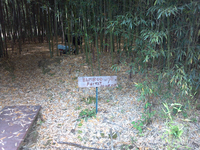
There were a few parts that wasn't perfect due to the roots buckling the path but otherwise the Chief Ladiga trail is a nice asphalt trail.  I'm sure I would still have complained had I ridden on 26 inch wheels instead of 16 inch.  I stopped at a bamboo forest that was right next to the path. I didn't knew that bamboo grew in the US.  It was pretty cool as it was mature and I could go into it.  On the Alabama trail were mostly local kids that rode their bikes and stray dogs that don't chase bicycles.  Instead I scared them when I approached and rang the bell.    The whole trail is shaded by trees.  On the trail a police car pulled over a four-wheeler since motorized vehicles are strictly forbidden on the trail.  Makes me wonder if e-bikes would be allowed.  The part through the Talladega national forest was cut through the hills and was a longer stretch that didn't pass through towns.  Soon after the national forest I crossed the border into Georgia.  At that point I was exhausted and salt covered from sweat.  But I pushed forward to reach Cedartown for dinner and then Camp Comet for the night. In contrast to the Chief Ladiga trail the Silver Comet trail is nice smooth concrete.  The first section even had a couple of metal awnings setup in middle of nowhere as a rain shelter which would have come handy had it rained.

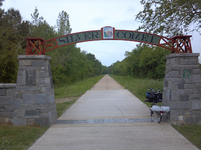
At the beginning of the trail.

Bamboo forest next to the trail.

Somewhere near mile marker 22.5 on the Chief Ladiga trail.

The project that never happened.

Alabama - Georgia border.

I arrived in the evening in Cedartown and the local businesses were closed already.  I had to go further into town to reach the more common fast food restaurants.  Being stupid I didn't fold my bike asked if I could take it into the Subway restaurant.  Of course the employee said no and leaving it outside was a no-go for me.  So I went next door to a local Chinese restaurant, folded the bike and carried everything inside.  They didn't know what to make of it and nobody commented on it.  Unfortunately Chinese food wasn't what I needed being this exhausted and the food smell wasn't much help either.  I ended up to eat only a little before continuing on.

On the way out of town I filled my water bladder and strapped it on the rack with the tent and sleeping mat.  The ride to the Camp Comet camp site dragged out as the sun was setting and the trail was quite hilly, not being on an old railroad track for this stretch.  Because of exhaustion I pushed the bike on the steeper hills.  I finally arrived the spot where the camp site should have been but the forest there was fenced of from the trail.  That didn't look good.  In addition to that it was already dark.  I decided to ride a bit further than where my GPS indicated the camp site should be and soon found a signage for the camp site and a gate at the fence.  I pushed the bike into the forest along the hiking path.  Not very far in were the tent pads, nicely build up.  But the gravel fill gave me some issue with the tent stake that didn't hold in it.

I'm quite surprised that the folded Brompton fits into the vestibule of the Tarptent Moment without blocking the entry of the tent.  The night was a bit noisy with deers coming into the valley where the camp is to drink water at the creek that ran past my tent.

Tent at Camp Comet.
(Do you see the bicycle?)

Entrance to the Camp Comet primitive camp sites.
While the first day was a bit tough with squeezing a 60 mile ride into half a day, the second day was much easier since I had all day to ride the remaining 60 miles.  Riding a bike trail you're kind of isolated from stores and restaurants this also applies to the Chief Ladiga / Silver Comet trail.  I did find a Waffle House not to far off the trail where I stopped for a big brunch.  Getting closer to Atlanta also meant that there were more recreational users of the path, especially since it was a Sunday.  Most of the guys in Lycra on their race bikes weren't going faster than I did.  Serious bikers hit the rural roads where they don't have to worry and fight the crowds. Some passed me, I passed others and even played tag with a couple riders that were taking frequent breaks.  Six speeds and tiny wheels doesn't mean you're slow.

Riding in Atlanta was quite interesting.  The roads are patchy and have lots of pot holes.  One road had bicycle chevron painted on it but with the road condition you had to ride in the middle of the road and constantly swerve the pot holes and bad patches.

Tunnel on the Silver Comet trail.

Mile marker zero of the Silver Comet trail.

Atlanta skyline.

On this trip I used my phone to take some videos of my ride.  I curious if you'd rather read the blog, watch the video or both.


Below is the full route from the Greyhound bus stop in Oxford, Alabama all the way to the hotel in Atlanta. Added to it is also a loop to Decatur where I went for dinner one evening.


Bike route 1550212